Hall Road, Belchamp Walter
Hall Road, Belchamp Walter, runs East from the crossroads towards Belchamp Hall (hence its name).
There are a number of Listed buildings on Hall/Church Road , most of which are outside the current village envelope (conservation area).
Shown below is an Ordnance Survey Office map of Hall Road from 1897.
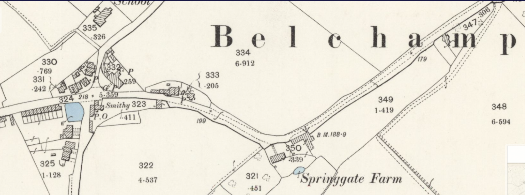
Shown North of Hall Road are the Croft Cottages on the hill running down from the crossroads towards Springgates Farm. The dwellings South of Hall Road include the Blacksmith's and what is now known as Rose Cottage. The 1891 census refers to a "Cottage near Croft", this could be Rose Cottage or it could be one of the flint cottages North of Hall Road.
The Playing Field
The land to the East of Springgate Farm is now the village playing field and the Round House cn be seen between the "a" and the "m" in the word "Belchamp" on the map. The Round House is believed to be a gate house for Belchamp Hall. The Road House is listed as unoccupied in the 1891 census.
Listed buildings on Hall Road - none in the Conservation Area
The two listed buildings on Hall Road are Springgates Farm and The Round House. Hall Road becomes Church Road at the "t" junction that leads to the entrances of The Munt Farm, Munt House and the stable entrance to Belchamp Hall.
Continuing past the church on Church Road you pass The Munt Cottage, Hall Cottage and then Mill House, all listed buildings. Church Road is commonly known as Hall Road but this in not strictly correct.
The houses South of the Crossroads are not listed and date from the 1850's apart from Rose Cottage which is of an earlier date (unknown - but is shown on the OS map of 1897 but not on the Chapman and Andre map of 1777).
The 1897 OS map shows a dwelling on Hall Road that could have been known as Croft Cottage(s).
The 1891 census lists residents of these cottages.
While the Croft Cottages are not listed they are significant to the history of the village. The same cannot be said of the shed that was formerly called "the Mission Hut". In keeping with all dwellings changes to their structures are governed by planning rules. The cottages that are formely no. 2 and no. 3 Croft have been converted into a single dwelling and there is no planning permission granted by Braintree District Council for this to be done. In addition, all the Croft Cottages front directly onto Hall Road and have no parking spaces as part of their footprint.