Old Maps of Belchamp Walter
A map is probably one of the most recognisable resources that contemporary technology users are familiar. We have maps on our phones and sat-navs, the map provides a visual image that can provide a reference for many.
I started looking at the maps I found on the National Library of Scotland in respect to Belchamp Walter water mill
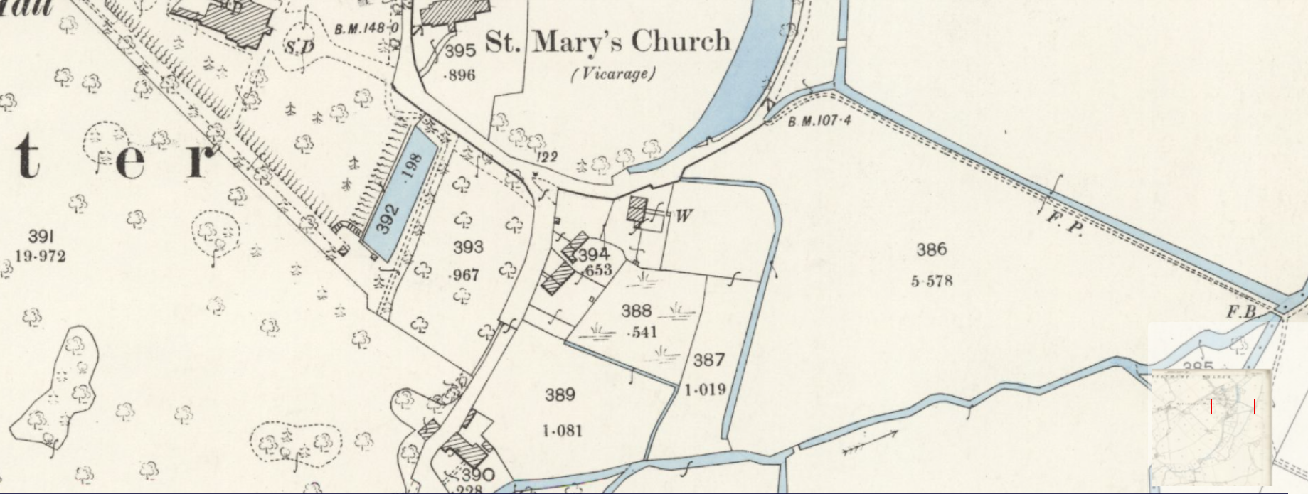
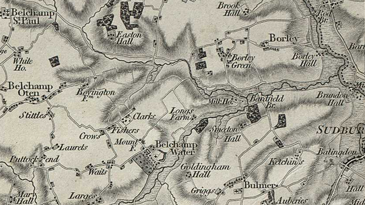
Below are a couple of maps that I have featured, the 25 inch map is of the area south of St. Mary's church and the other map (another OS map) is of the general area.
Ordnance Survey Map - 25 inch England and Wales, 1841-1952

A Vision of Britain (1st edition of OS?) 1856:

The copyright notice for visionofbritain.org.uk (CC-by-SA license):
Note: the link to visionofbritain.org.uk is no longer valid or the security has lapsed - it is included here for reference only.
Roads that are no longer existant
The OS First Edition map of 1856 shows roads that do not exist in 2021. The road from Mount Farm (Munt Farm) extends to the road between Clarks and Fishers, it is now a footpath. The road from the T-junction that now goes past Newbon to Clarks Farm did not exist.
The road down to Longs Farm which no longer exists or does the farm.
Using the National Library of Scotlands database of maps
I have provided a link to a map of Belchamp Walter that I found on NLS. I have also started a guide to the use of these maps and try to explain how to use their website. It is not straight forward and I see that Foxearth Historical Society have had an event in 2020 on this topic. (see their website - link below)
The Chapman/Andre map of 1777

The map shows the Hall as Rev'd Mr. Raymond, the same map for Faulkborne Hall shows Bullock
The 1777 map also shows Belchamp Walter Mill and the mill race.

Background to this page
This page is page of my study of the area of Belchamp Walter, Essex.
I also live in the house at the centre of the map at the top of this page.
The old version of this page was found by Internet users, November 2022. The old page was removedfrom the server and this page submitted for re-index. In addition a Shim Link facility was added to external links.
Topographic survey belchamp walter
Bevingdon House
Bevingdon House is shown on the OS map and is between Belchamp Walter and Belchamp Otten.